


| Oliver's Cornwall |
|
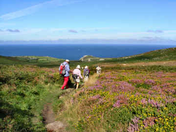
cyclists and horse riders |
|
|
|
|
|
Horse riders, if they don't already know it, should go to the superb BHS Access Cornwall site for bridleways, tracks and horse paths. |
|
|
|
|
|
| Camel Trail | *Padstow to Wenford Bridge, on former railways, following the River Camel | 18 miles |
| The Bude Canal | The Tamar Lakes arm is walkable in part, about 10 miles out of the total original length of 13 | 13 miles |
| Clay Trails | *Individual trails in china clay country near St. Austell. Several of them link at Eden | 33 miles |
| Copper Trail | Around Bodmin Moor, created by moorland expert Mark Camp | 60 miles |
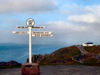
| Land's End Trail | A Long Distance Trail from Land's End to Avebury in Wiltshire, no coast but much high ground | 334 miles |
| Mining Trails | *Multi-user trails around Camborne/Redruth, includes a Coast-to Coast Trail | 50 miles |
| Penwith Round | Circular extension to the Land's End Trail, starts on Trencrom Hill, finishes in Penzance | 38 miles |
| Saints Way | Coast-to-Coast: Padstow to Fowey, following the steps of holy men and traders, 30 miles plus alternative | 45 miles |
| St. Michael's Way | Coast-to-Coast: Lelant, near St. Ives, to Marazion and St. Michael's Mount | 12 miles |
| Smugglers Way | Coast-to-Coast: Frank Squibb's route from Boscastle harbour to Looe harbour, crossing Bodmin Moor | 37 miles |
| Tinners Way | Combined with the Zennor Churchway, farmland from St.Ives to Cape Cornwall, back over high moorland | 31 miles |
|
|
|
|
|
|
|
|
|
|
|
|
|
|
|
|
|
|
|
Online
Mapping - Cornwall Council's Mapping Website
 |
'Right to Roam' legislation, the Countryside and Rights of Way Act, - long agitated for by the Ramblers Association, and initially opposed by many landowners - has resulted in vast areas of land all over England, Scotland, Wales and Cornwall being opened up to the general public. Essentially these rights are for walkers only - suits me. I used to find the Countryside Agency's Open Access website an immense help in my Cornwall moorland walking, not just on Bodmin Moor but also in West Penwith. Unfortunately the site, now Natural England, has been messed around with and although the maximum scale is acceptable, maps are too small and navigation is quite awkward. As a result, it is no longer worth, as a walker, using it in its current CRoW Access form. Fortunately, Cornwall Council has an excellent mapping web site, which I find better than the Open Access site ever was. It is easy to use, shows Open Access land, rights of way, cycle trails, path numbers should you wish to report problems, and is zoomable up to large scale. A word of warning on Open Access land. I soon discovered that this may not be quite as straightforward as that. I have encountered barbed wire fences, locked gates and even one gate on Bodmin Moor, leading to access land, that has a 'no walkers' sign on it. And, in West Penwith, where moorland is lower, I have found impenetrable furze and bramble. So don't expect it always to be easy. |
|
|
OS Explorer maps now show Open Access land as yellow |
Ordnance Survey Maps - The 1:25000 Landranger Series
 |
My earliest walking was done with Jane with the Independent Ramblers, based in Ealing. With them we learned to love the Chilterns and the Cotswolds. But we soon graduated to our own independent walks, first from walk books, later of our own devising. The Ordnance Survey 1:25000 series became our bible. The current 2005 Explorer series still is my bible (to a degree) particularly as it now shows Open Access land. But, as with the Bible, you learn not to believe every word. I use OS maps, GPS and compass on most walks, especially on Bodmin Moor and on the moors of West Penwith. But I have lost some trust in OS. Since completing Mark Camp's Copper Trail during winter 2006, I have been walking routes of my own devising on Bodmin Moor and have been horrified to discover just how unreliable the Ordnance Survey can be. A couple of walks in December 2006 proved that. A path shown from Butterstor to Garrow simply does not exist yet OS quite fails to show a well waymarked path from Brown Willy to Garrow (and on to King Arthur's Hall). Below Garrow the OS fails to mark a footbridge over the De Lank River. It also fails to show a footbridge and clapper bridge that cross the river at the southern foot of Garrow Tor. Elsewhere I have found marsh that isn't shown, probably because it is not low-lying. So be advised, take your map, take your GPS, take your compass and expect the unexpected. |
|
|
Don't expect all antiquities to be marked either |
Walking Trail Books
- Our Preferred Guides
 |
CIRCULAR WALK GUIDES
I Walk Cornwall: John Alden's comprehensive online Cornwall walk guide. OS Maps, detailed directions. Jarrold Pathfinder Cornwall Walks: 28 walks, most include coast, distances 4 to 11 miles. Good large scale Ordnance Survey maps, good descriptions and information. AA 50 Walks in Cornwall: Mostly coast but includes about 10 inland, 3 to 8 miles. Good descriptions and information, sketch maps could be much better, good on severity. Classic Walks in Cornwall: 2 volumes, each of 60 walks, all but 5 include coast, 3 to 6 miles. Good descriptions and information, poor sketch maps, good on severity. Circular Coast Walks Cornwall: by Moor, Dale and Mountain Press. 36 walks, 3 to 10 miles. Good information, routes not too clear, sketch maps. Ramblers Association Cornwall: has published 14 volumes, each of 6 or so walks. Bodmin Moor Walks: Best of Bodmin Moor by Mark Camp; 18 short walks in three volumes. TRAIL GUIDES
|
|
|
| WALKABOUT WEST
Mark Camp offers guided walks generally in Cornwall and especially on Bodmin
Moor. Mark is one of the experts on Bodmin Moor: its
history, its antiquities and its industries - tin and copper mining, granite
quarrying aned china clay production. Mark has also published a number
of books about Bodmin Moor - three books of Short Walks, a new (March 2009)
Introductory Guide and a guide to the trail that he devised, the 60 mile
Copper Trail around the moor, carefully divided into six ten mile sections
and including descriptions of a lot of interest along the way.
Links: The Best of Bodmin Moor Books - The Copper Trail - Mark's WalkaboutWest Other Guided Walks
|
 |
| I am sure there are many others but I don't know them |
|
 |
Until the 1970s a branch railroad in the Camel Valley linked Padstow and Wadebridge with the main line at Bodmin and with the old Southern Railway route to Waterloo. Now it is an 18-mile hiking, horse riding and cycling trail, extended to Wenford Bridge on a former quarry tramway, again alongside the river. For the cyclist it then effectively continues as the Camelford Way as far as the town of Camelford, making a total trail of some 26 miles. If you are visiting Bodmin, a short extension from Dunmerel follows what was once a packhorse route into town as far as Bodmin Jail. You can get refreshments in Padstow and Wadebridge, at a tea garden near Dunmere, at the excellent Borough Arms at Dunmere and at a tea room off the trail in Tresarret. Walkers, beware summer vacation time when there can often be far too many cyclists for comfort, particularly between Padstow and Wadebridge. Horses and walkers are supposed to take precedence over cyclists but not many cyclists choose to acknowledge that. Bikes can be hired in Padstow, Wadebridge and Bodmin. Wadebridge Bike Shop, www.wadebridgebikeshop.co.uk, 9 Polmorla Walk, 01208 815262, is recommended for new and used bikes, for hire and for in-shop repair. The most interesting section to walk is between Padstow and Wadebridge which follows the delightful estuary of the River Camel, a great draw to enthusuastic birdwatchers. |
|
|
Trail leaflet from TICs. Go to my Camel Trail page |
The Clay
Trails - Cyclists, Horse Riders and Walkers
 |
We were delighted when in June 2005 the new Cornwall Clay Trails opened, in conjunction with improvements at Wheal Martyn Country Park and Museum of China Clay. It took a lot of co-operation and clearly a vast amount of money to complete the project. The bodies involved included Cornwall County Council, the Eden Project, the National Cycle Network people Sustrans, the Lottery Fund and Imerys, the company that operates the vast clay fields. The Clay Trails are essentially Cycle Trails. Paths are wide, firm and well drained, the few gradients are relatively gentle and their clear purpose is to encourage people to arrive at the Eden Project (so many go there) by bike. There are effectively four Clay Trails. Wheal Martyn to Eden, with a detour towards Carthew, definitely the scenic trail and the best for walkers. Bugle (where you can rent bikes) to Eden, not very scenic, except for a detour on foot round Treskilling Pit. Par Beach (near Imerys clay exporting harbour) to St. Blazey, with a footpath extension to Eden. And Wheal Martyn to St. Austell, which can continue south to link with the Pentewan Valley Trail. Simple waymarking is good and explanatory displays are being installed at some points of interest. Occasional shelters along the way have cob walls and domed grassy roofs. |
|
|
NOW go to my Clay Trails page Trails website |
| Update June 2008. I learned from surveyor and map maker Ernie Biddle that there are now aditional off-road links to the clay trails. A link seems to be planned from the Goss Moor Nature Reserve trail to the trail from Bugle to Eden. And, if you are on the Pentewan Valley trail south of St. Austell, you will find continuations to Heligan Garden and Mevagissey. |
The Copper
Trail - circular trail round Bodmin Moor
 |
Mark Camp is known as an authority on Bodmin Moor and has published several books of walks. In 2005, he excelled himself with a continuous 60 mile trail around the moor, which he calls the Copper Trail, appropriately since Minions and Caradon Hill were once the centre of a great copper mining boom. The Trail begins at Minions village and goes by way of St. Neot, Bodmin, St. Breward, Camelford, Five Lanes (near Altarnun) and back to Minions. After completing the Cornish Coast Path, this was my next project. But, unlike Mark's route, I did it in a series of short out-and-backs or circulars. In winter 2006 it proved very wet and muddy - but none the worse for that - with an enormous amount of interest, with high moorland (I love it), remote farms, ancient monuments, clapper bridges, Cornish crosses, boundary stones and mine ruins along the way. Thanks to Mark, I have now devised and enjoyed many of my own walks on the moor. Recommended pubs along the trail are the Crows Nest, the London Inn at St. Neot and the Old Inn at St. Breward. I have had many good lunches at all these and also enjoyed the King's Head at Five Lanes and Racehorse at North Hill. For a description of the route you can't better Mark's booklet; I have just added a selection of photos taken along the way, some on-trail, some off - and a few comments. The complete route is on Ordnance Survey Explorer sheet 109. |
|
|
Go to my Copper Trail page or Official Copper Trail Web Site |
The Land's
End Trail - Land's End to Avebury - 334 miles
 |
The Land's End Trail was conceived by Hugh Miners and researched by Cornish Ramblers Robert Wicks, Robert Preston and Robin Menneer. It runs from Land's End to Avebury in Wiltshire, a distance of over 300 miles. It was Robin Menneer of the Guild of Cornish Hedgers who told me about it in 2007. I found the route, in an east-west direction, in The Celtic Way by Val Saunders Evans (Sigma Leisure 1998). I made it my project for 2007 and published to the web the route and my experiences on it. Much as I enjoyed the exercise, I was puzzled that the directions took me only to St. Michael's Mount, with a subsequent loop - the Penwith Round - from Mousehole via Cape Cornwall to Penzance. It was not until 2008 that I learned from Robin that the original west-east research notes still existed. It transpired that Robert Preston was re-walking the trail in that direction, doing clearance and restoring chevron waymarks. My 2008 project beckoned and, accompanied by friend and neighbour Richard Lowe, I walked the trail from Land's End to Tavistock. I continued to Belstone in Devon where Robert took over in 2009. With the encouragement of the original LET Group I have expanded the route notes and have compiled web pages. These consist of a Home Page, PDF files with sketch maps and directions, and a sketch map of the overall route. |
|
|
NOW go to my LAND'S END TRAIL HOME PAGE |
| UPDATE AUGUST 2014: Originally Olivers Cornwall Land's End Trail pages included not only Route Directions and Map, but also Interest, Commentary and other pages. The Land's End Trail pages were heavily edited in August 2014 and now are essentially just the Route Directions and Sketch Map. |
|
In 2006 UNESCO World Heritage status was granted to large areas of the mining landscape of Cornwall and West Devon. While much of the credit for this achievement must go to organisations like the Trevithick Trust and the National Trust, and to many concerned individuals, Cornwall County Council acted as a major driver. Indeed their Mineral Tramways Project has, in its way, underpinned the whole business by opening up access to many of the important sites in the Camborne/Redruth area. We first discoverd about the existence of mineral tramways when walking around Minions on Bodmin Moor and finding double lines of granite setts. When we learned about the opening of the first Mining Trails - the Great Flat Lode and the Coast to Coast - we walked those and loved them. In 2006 work began to open up another 20 miles - the Redruth and Chacewater Railway Trail , the Portreath Branchline, the Tolgus Trail, the Tresavean Trail and a Tehidy Trail through Tehidy Park from Portreath. Opening of these was originally planned for 2008. As so often with grand publicly funded projects, the timetable slipped and it took until 2010 for all except one to be completed. Tolgus Trail was never even started but I have devised my own walkers route which links the Coast-to-Coast at Scorrier with Tolgus Tin by way of the superb Wheal Peevor site. |
|
|
NOW go to my Mining Trails page |
| UPDATE AUGUST 2010: Despite a grand launch of the new trails, held at the Elm Farm Cycle Centre at Cambrose on 26 September 2009, the new trails didn't open until 2010. The Redruth and Chacewateris complete, linking the Coast-to-Coast at Twelveheads with the Great Flat Lode and Redruth Church Town. The Portreath Branchline was the last one finished and now links Portreath to the Great Flat Lode at Brea Village, thus completing a new longer, and more interesting, route from Portreath to Devoran. Sadly it looks like the Portreath Incline will not after all be the crowning glory of this trail but, at least, there is an alternative route down to Portreath from Gwel-an-Mor. The 2 mile Tresavean Trail, off the Redruth and Chacewater, was completed some while ago. The Tehidy Trail is also complete but is not really a Mining Trail. My own Tolgus Trail runs from the Coast-to-Coast at Scorrier and links Wheal Peevor and Tolgus Tin with the Coast-to-Coast at Bridge. You may also like to consider my own partly cycle-free Alternative Coast-to-Coast. |
The Penwith
Round - 38 miles Mousehole to
Penzance, 51 from Trencrom Hill
 |
Unlike the Land's End Trail which, until I got my hands on it, eschewed mention of anything of real significance along the way in its hurry to get there, the Penwith Round, an extension of the Land's End Trail, seems to have another purpose entirely. The purpose is not so much to get you from A to B as to educate and entertain you along the way. There is a full route description but there is also a great deal of antiquarian and historical description as the Round leads you meanderingly from one prehistoric site to another. The Penwith Round route description begins with a stage from Trencrom Hill to St. Michael's Mount. It then omits a few miles of obvious Coast Path and takes up again at Mousehole. Stage 2 is Mousehole to Treen, 3 is Treen to Crows-an-Wra, 4 is Crows-an-Wra to Cape Cornwall and 5 Cape Cornwall to Penzance. Ancient highlights along the way include the Merry Maidens and Pipers, Treryn Dinas cliff castle, Boscawen-ûn circle, the crosses and holy well at Sancreed, Carn Euny iron age village, Chapel Carn Brea, Bollowal Barrow, Chûn Castle and Quoit, Bodrifty iron age village and Mulfra Quoit. Buses were useful but I had to split the Treen to Crows-an-Wra section in two. Reports do not include route directions - only comments on them - you can access the full directions below. |
|
|
Penwith Round Page - Download PDF Penwith Round description |
The Saints
Way - a Trail from Padstow to Fowey
|
In Cornish 'Forth an Syns', in English 'The Saints Way', this trail has also been known as the 'Mariners Way'. The 30 mile route links two important harbour towns, Padstow on the north coast and Fowey on the south. While there may be no evidence that this really was a route used by traders and holy travellers between Ireland, Wales and Britanny in early Christian and prehistoric times, it's a nice conceit and makes an enjoyable and different coast-to-coast route. And it is fair to say that there are plenty of Cornish crosses and standing stones along the way, suggesting a possible ancient cross-country route. Created in 1986 by a group of Cornish hikers and students of history, the Saints Way has the support of the Cornwall Council and was being upgraded and improved in 2006. Having completed the Cornish Coast Path in 2005, and Mark Camp's Bodmin Moor Copper Trail in early 2006, the Saints Way was my May/June 2006 project. It gets complicated at Helman Tor as there are then two routes to Fowey, one by Luxulyan, the other by Lanlivery. As with the Copper Trail, I have just posted a few images of each section, along with a short description. It was good walking and mostly fairly easy. Waymarking is mostly clear, using a black cross and yellow direction arrow, but is a little lacking in places and may be a little confusing in some others where posts have become loose. |
|
|
Go to my Saint's Way page, but first click for Trail Guides |
The Saints Way - the Trail Guides
| The original bible of the trail is a hundred page book, prepared by Michael Gill and with historical notes by Stephen Colwill. One way or another, many others were involved - Cliff Townes and Alf Fooks, who had the original inspiration, the Ramblers Association, the Institute of Cornish Studies, the CRS Community Programme, even the Cornish Gorsedd of Bards. This guide, at over 100 pages, is not ideal to carry with you but is well worth reading through for history and background. Its maps are indistinct. The essential guide now is the 2006 Saints Way Guide, published by North Cornwall District Council. A folder with 8 trail cards (and 5 information cards), each trail card covers about 5 miles, has a good map and an accurate description of the route from Padstow to Fowey. There are good small photographs and information on points of interest along (and just off) the way. The folder and information cards cover the saints, pilgrims, church features, man and the landscape, wildlife and nature reserves. As the folder suggests, you would do well to carry Ordnance Survey Explorer maps 106 and 107 with you. I have three criticisms - too much road for my taste, occasionally unclear waymarking and too few decent pubs along the way except in Lanivet, Lanlivery and Golant. |
 |
| NOW go to my Saint's Way page |
|
St. Michael's
Way - for walkers only
|
Like the Saints Way, St. Michael's Way has been around for some time and claims to be a logical route for ancient travellers heading from Ireland and Wales to avoid the perils of Land's End and the Scilly Isles. It begins at St. Uny Church at Lelant on the north coast and ends 12 miles later at Marazion on the south coast, opposite St. Michael's Mount. In fact travellers would have sailed up the Hayle estuary to St. Erth and had only five miles to Marazion - but that would hardly have qualified as a trail! To make it a worthwhile distance, the trail first follows the coast path to Carbis Bay, then heads inland to Trencrom Hill, the halfway point. Do climb the hill for views. Then it's downhill all the way to Marazion. Easily walked in one go, using the 300 bus between Lelant and Marazion, but I chose to do is as two round walks. As with the Saints Way, it is waymarked with its own symbol, in this case a scallop shell. And as with the Saints Way, the route is not always entirely clear, so it wold be wise to take OS Explorer sheet 102. |
 |
|
|
NOW go to my St. Michael's Way page |
|
The Smugglers
Way - 37 miles from Boscastle
harbour to Looe harbour
| This was my winter 2009 project, which I had hoped to walk with friend and neighbour Richard. Unfortunately Richard got an injury and I ended up doing the walk solo. The Smugglers Way was the creation of the late Frank Squibb of Falmouth, who walked it in 1994 and had published three editions of his guide booklet, the latest version in 2002. If you are competive (I'm not) you could go for Richard Harvey's record of 6 hours and 48 minutes one way (he must have been running!) or Dave and Anne Carrivick's there-and-back time of 21 hours and 37 minutes. Frank's booklet describes the route in both directions with sketch maps. Route descriptions are clear and easy to follow, maps are detailed enough. Frank divides the route into 8 short stages, the longest 7.2 miles. From north to south - the way I walked it - the trail runs from Boscastle harbour to Davidstow Moor, over the summit of Brown Willy, on to Jamaica Inn, by Dozmary Pool and over Brown Gelly to Dobwalls, on to Herodsfoot, and along the West Looe River to the Banjo Pier at Looe. There is camping at New Park Farm on the edge of Davidstow Moor and at Lower Trenant near Draynes. I divided my walk into four sections averaging around nine miles each. I used OS Explorer maps 111, 109 and 107 to help supplement Frank's directions and maps. |  |
| Now go to my Smugglers Way reports page |
|
| Sadly, Frank Squibb died in January 2013. I am disappointed that no one has kept his excellent Smugglers Way web site going. |
Zennor
Churchway and Tinners Way - 31 mile round trail
|
I had known of the Zennor Churchway, by that name and also as the Coffin Path, for some while before I started this project. I also knew of the Tinners Way or Old St. Ives Road. I had walked some of both while doing round walks and helping re-research the Land's End Trail. However, I didn't know the full details of either until I searched on the web and found an article in The Ley Hunter by Craig Weatherhill - Cornishman, historian, novelist, artist, antiquarian, horseman, Cornish language expert and nationalist - about the Zennor Churchway, and another on Save Penwith Moors about the antiquity of the Tinners Way. I searched further and found Men-an-Tol Studio artist Ian Cooke's detailed Tinners Way guide, based on research by Hugh Miners and Craig Weatherhill. Craig's Zennor Churchway identifies innumerable crosses, cross bases, field and place names, and prehistoric settlements that all lie on a clear right of way between St. Ives and Pendeen. However he concludes that it is a route for the spirits of the dead, or follows natural lines of force, or relates to witchery. The Tinners Way may not have followed the published route. Its main track may have finished in Penzance not St. Ives. I have devised a trail which uses the Churchway to Pendeen, added my own familiar route to Cape Cornwall, returning to St. Ives on the Tinners Way. Before walking this trail, do look at the links below. |
|
|
Trail starts in St. Ives, returns over moors from Cape Cornwall |
| Craig's Zennor Churchway article with map and Ian Cooke's detailed Tinners Way guide with maps both seem to have disappeared from the web. Why can people not be bothered to maintain these useful resources. |
CORNWALLREVIEWS
INDEX and SITE CONTENTS
|
|
|
|
|
|
|
|
|
|
|
|
|
|
|
|
|
|
|