| The Land's End Trail | Tavistock to Avebury | Trail Interest |
|
|
|
|
|
|
|
|
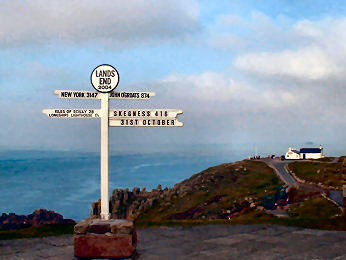
| The Land's End Trail was originally conceived by Hugh Miners and was researched by a group of Cornish Ramblers - Robert Wicks, Robert Preston and Robin Menneer. They researched and published the route from Land's End to Avebury in the early nineties. Route details from Land's End to Tavistock have been more-or-less finalised. To see them click on Cornish Section below. The draft details of the LET from Tavistock to Avebury are, for the time being, available (£5 post paid) from Robert Preston (Tel: (0) 1 872 262 334). Robert Preston has been re-walking and updating the Trail directions from Tavistock to Avebury. This page will be Robert's commentary on the route, stage by stage, with a characterising image for each stage. A separate page will describe, with images, the interest highlights along the way, shown in the Trail text in bold italics. For the time being trail maps appear as sketch maps. Better maps are under development. In due course the complete LET will appear on these pages as Land's End to Avebury in both directions. FOR CONVENIENCE, WE SUGGEST OPENING THE PDF FILE IN A SEPARATE TAB. |
|
Return to Tavistock to Avebury Home Page |
Index of the Interest Tavistock to Avebury |
A commentray on the route from Tavistock to Avebury |
The route from Land's End to Tavistock |
Return to LET Home |
|
|
|
|
|
|
INDEX TO THE INTEREST HIGHLIGHTS ALONG THE LAND'S END TRAIL
|
|
|
|
Peat Passes |
|
|
|
|
|
|
 |
At first glance the sleepy Devon village of Lydford seems an unlikely candidate for a site important to both Saxons and Normans. A closer inspection offers clues. The great bank near the village hall is apparently of Saxon origin, part of Alfred's defensive Burgh system, designed to repulse both Vikings and the Cornish. The castle keep, adjacent to the church, suggests that the Normans still considered Lydford of strategic importance when they built it in 1195, replacing an earlier one. In late Saxon times Lydford even had a mint, famed for the silver Lydford Penny. Next to the castle, the church commemorates the Cornish St. Petroc. While it is possible that Petroc himself founded the first church here, the present building dates from the 15th century. Inside is some fine 20th century woodwork, especially the intricate rood screen, and the grave stone of watchmaker George Routleigh, bearing an entertaining epitaph. In the graveyard are some odd gravestones, a massive rock commemorating Daniel Radford and a group of small circular stones of a family whose name began with W. Lydford Gorge, now owned by the National Trust, is a spectacular wooded ravine in which waterfalls tumble into the the River Lyd. The Castle Inn, a friendly place, has good food and comfortable rooms. The village is on the West Devon Way, the Lich Way and the Granite Way. |
|
|
Signed from A386 Tavistock to Okehampton |
 |
Dartmoor Railway, also known as the Dartmoor Pony Steam Railway, acquired rights on a 15 mile line that escaped being axed by the notorious Dr. Beeching. The full lenrth of line runs from Meldon Quarry to link with the Tarka Line, which runs from Plymouth to Barnstaple, at Crediton. A couple of main line trains operate between Okehampton and Exeter daily. The Dartmoor Railway plans to operate along the full route eventually but so far has only managed Meldon Quarry to Okehampton, apart from the occasional excursion from Exeter. The sad thing is that, had the Dartmoor Railway been able to acquire and restore what Beeching did close, there would be potential for the Dartmoor Railway to continue south to Tavistock. At the Meldon end the station was that of Meldon granite quarry. Just beyond the station is an impressive viaduct, 120 feet above the West Okement Valley. The station area itself is jam-packed with old rolling stock and diesel engines. There is a visitor centre and a buffet car, overlooking the viaduct, serves food all day. At the Okehampton end, the station is in nicely maintained The goods shed behind the station is now a YHA youth hostel and activity centre. The best reason to visit the statiion is for the excellent station buffet where charming volunteer ladies provide hot snacks and excellent tea, coffee and cakes. |
|
|
Dartmoor's Railway's web site - includes timetable |
| The 365 square mile Dartmoor National Park occupies a large corner of south-west Devon. High moorland, topped by odd rock formations, rises to around 2000 feet. Below are lush valleys, torrential streams, woodland and some attractive villages - best are Buckland-in-the-Moor, Chagford, Widecombe, Lustleigh and North Bovey. On the moors, dotted with pre-historic remains and old mine workings, sheep and native ponies graze. Dartmoor is popular with tourists so villages and beauty spots - such as Postbridge, Dartmeet, Fingle Bridge, Canonteign Falls and Lydford Gorge - can become over-run. Lanes are narrow and often high-hedged, making progress difficult; at busy times many visitors will content themselves withtaking the old road across the moor from Moretonhampstead to Tavistock or Yelverton. Features worth seeking out include ancient stone 'clapper' bridges at Postbridge, Dartmeet and Bellever; the pre-historic settlement at Grimspound; and Hound Tor medieval village. You may also like to see Princetown, high on the moor and dominated by its forbidding prison. I spent a day on Dartmoor in December 2007 visiting Widecombe, photographing clapper bridges and climbing Saddle Tor, Haytor and Hound Tor. Compared with Cornwall's Bodmin Moor, it surprised me how busy all these hills were. |  |
| The whole of Dartmoor is on the unwieldy OS OL28 sheet |
|
| DARTMOOR vs BODNMIN MOOR You might expect that two stretches of moorland so close to one another - a mere 15 miles separate them - would be pretty similar. Coming fairly fresh to Dartmoor, after years of Bodmin Moor walking, it has surprised me just how much difference there is. As a National Park, Dartmoor is generally completely accessible, except for occasional restrictions on the military ranges. Much of Bodmin Moor may be Open Access but access to some of those parts may be difficult (even impossible) to find. You may camp freely on Dartmoor; don't try it on Bodmin Moor without asking. Dartmoor is higher - 2000 feet as against 1400 feet at their highest - and, being much larger, feels more remote, particularly in its northern half. Dartmoor has more rivers, most rising in the northern half; most flow south but two, the Taw and East Okement floew north. Bodmin Moor's rivers all flow south. Slightly surprisingly, the wet land on Dartmoor, blanket bog or fen, is relatively easy to negotiate; some of Bodmin Moor's marshes are quite impossible to find your way through. Historic industries are similar - tin and copper mining and granite quarrying - but Bodmin Moor has more former china clay quarries but Dartmoor's are limited to Lee Moor in the south-west. Both moors are grazed by ponies, sheep and hardy cattle. Antiquities abound on both moors but, while Bodmin Moor's are well spread, there are relatively few in the northern half of Dartmoor. Dartmoor's villages are mainly in the southern half, Bodmin Moor's are spread round the fringes. |
 |
Much of northern Dartmoor, where so many of Devon's rivers rise, is covered by blanket bog. Probably since time immemorial this bog has been harvested for peat turves for fuel. In places the turf cutters would deliberately cut the peat right down to the bare granite below in order to link the flatter and easier parts of the bog with causeways to make access across the moor easier. In the late 19th century, at a time when fox hunting on the moor was common, a keen huntsman named Francis Phillpotts decided to cut more peat passes to make more of the high blanket bog accessible to the hunt. Under his direction, between 1896 and 1906 a team of moormen cut ten passes. Originally these were marked with wooden posts but these rotted rapidly or were destroyed by animals using them as rubbing posts. After Phillpotts death in 1909 his son and brother organised the erection of granite markers at each end of the passes; they were all in place by 1919 with memorial plaques affixed. Unfortunately, the granite markers were only 2' 6" high. Many became lost amongst vegetation though some have been restored. Because of the nature of the blanket bog the peat passes themselves have become overgrown and can be very dificult to find and to negotiate. But, if you are able, it is worth trying to find the marker at the foot of Black Ridge pass. |
|
|
Detailed peat pass information on Legendary Dartmoor |
Belstone and the Nine Stones Cairn Circle
| Belstone is an attractive small village with stone built houses and cottages, some beneath thatch. It is hard to believe now that it was once a mining village but copper mines once worked just to the east of Belstone and included a 50 foot waterwheel. Though probably best known for the 1973 film The Belstone Fox, the film was shot on Exmoor and in Somerset. The Tors Inn does accommodation and has a good simple snack menu; unfortunately it is not open all day. The Barton does B&B and good teas.There are several good easy walks on Belstone Common and on the Tarka Trail. Belstone Cleave, along the River Taw to the east of the village, is especially attractive. It leads to Sticklepath, site of Finch Foundry. Nine Stones Cairn Circle is easily found on Belstone Common, just south of the village. The cairn has been robbed out and many stones from the encircling ring are missing but it is still impressive, set below Belstone Tor and above the valley of the River East Okement. |
 |
 |
|
|
|
 |
Strictly speaking, this is not a foundry at all but a forge, founded in 1814 by the Finch brothers and in continuous production of hand tools for mining and agriculture right up until 1960. Even though you may know what you are going to visit, it still comes as a great surprise. Driving through the charming village of Sticklepath, you turn in through a narrow alley between houses on the main street and find yourself in a colourful lawned garden. There is a ramshackle wooden shed and two water wheels, one driven by a leaky wooden leat that passes overhead. Inside you are confronted by ancient machinery, driven by belts powered by the water wheels. National Trust volunteers man machinery and explain the history and workings of this charming relic of the past. There is a museum here, too, in which you can see examples of the things the foundry made - Cornish shovels, mining tools, sickles and even mole-traps - along with historic photographs. The contrast of the tranquil garden setting and the noise and bustle of the forge is remarkable and this is working industrial archaeology with a vengeance. There is a shop and a small tea room. The colourful garden seems to merge with an adjacent cottage garden and to one side is the back entrance to the thatched Devonshire Inn. |
|
|
Signed from A30 a little to the east of Okehampton |
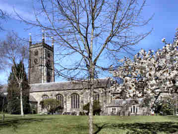
South Tawton and Sampford Courtenay - two good Devon villages
| Devon is a county with as many attractive villages as any. While South Tawton and Sutton Courtenay could not be described a picturebook, thay are both attractive places and, like so many Devon villages, their churches are the most outstanding features - and not just for the height of their towers. Both villages have a number of thatched cottages, some of them cob-built. Both have handsome 15th century churches dedicated to St. Andrew and blessed with fine carved roof bosses. South Tawton's has the grand 1592 tomb of John Wyke, Sampford Courtenay's has fragments of early stained glass. Both have a Church House, adjacent to the church, South Tawton's fine Tudor one having a small museum. Otherwise the villages are somewhat dissimilar. South Tawton centres on a small square, around it the church, Church House, cottages and Seven Stars Inn. Sampford Courteney's narrow main street climbs a hill from the New Inn on the main road. The church is at the top of the hill and has two entrances, one through a narrow alley with flower borders. In its churchyard is the remains of what must once have been a substantial preaching or market cross. Sampford Courtenay, surprisingly for a small village, has an estate agent. As Stage 16 is a short stage you will have the time to linger in both villages. You should find them worthwhile. |  |
| Sampford Courtenay and the 1549 Prayer Book Rebellion |
|
 |
You get to see a lot of the River Taw in three stages of the Land's End Trail. In Stage 14/15, if you are brave enough to traverse Dartmoor, you pass Taw Head, the spring where the Taw rises. You then cross it at the ford by the former Knack Mine in Steeperton Gorge on the way to Belstone. In Stage 16 you encounter the Taw almost immediately, dropping from the village down to the river in Belstone Cleave, staying with it to Sticklepath and then crossing it at Taw Green. In Stage 17 you follow the Taw much of the way from Sampford Courtenay to Chulmleigh. 45 miles in length, the river reaches the sea at Barnstaple where its long, broad estuary is joined by the River Torridge, having previously become tidal at Newbridge, around 12 miles from the sea. The Taw is probably best known as the setting for Henry Williamson's darkly charming book, Tarka the Otter, set on the lower reaches of the river. Otters are indeed still on the Taw today but there is more commercial wildlife in its waters, brown trout and salmon, though the salmon are rather in decline. The countryside through which the river passes is a delight: steep wooded valleys and quiet pastoral landscapes. It is just a pity that for most of its last 15 miles it is rather too closely paralleled by both the railway and the busy A377 road. |
|
|
Photo most kindly provided by Gerry Dunlop of Zeal Monachorum. |
| Exmoor National Park covers 267 square miles of Devon and Somerset. It extends along the Bristol Channel for 30 miles from. Combe Martin in the west to Minehead in the east. Inland it stretches 15 miles south to Dulverton in a roughly triangular shape and includes the Brendon Hills in the east. Where Dartmoor rises to around 2000 feet, Exmoors highest point is Dunkerry Beacon at 1700 feet. Much of the ground is a high plateau around 1400 feet and the dominant impression is green heavily wooded valleys, high heather moorland, home to red deer and game birds, and grazing land between. Main rivers are the Exe and the Barle, both rising near Hoaroak Hill, the Barle joining the Exe at Dulverton, the Exe entering the English Channel at Exmouth. Smaller rivers flow north to the Bristol Channel, notably the East and West Lyn which run through the well known beauty spot of Watersmeet. Another popular beauty spot is near Hawkridge, the remarkable clapper bridge of Tarr Steps. Attractive small towns within the National Park include Simonsbath, Exford, Winsford and Withypool. At the extremities of the park are 1043 foot Great Hangman Cliff near Combe Martin and 374 acre Wimbleball Lake reservoir, a major water sports centre. The Lands End Trail is within the National Park from Twitchen on Stage 19 to Upton, beyond Wimbleball Lake, on Stage 20. |  |
| Exmoor features in stages 19 and 20 of the Land's End Trail |
|
|
Return to Tavistock to Avebury Home Page |
Index of the Interest Tavistock to Avebury |
A commentray on the route from Tavistock to Avebury |
The route from Land's End to Tavistock |
Return to LET Home |
|
|
|
|
|
|